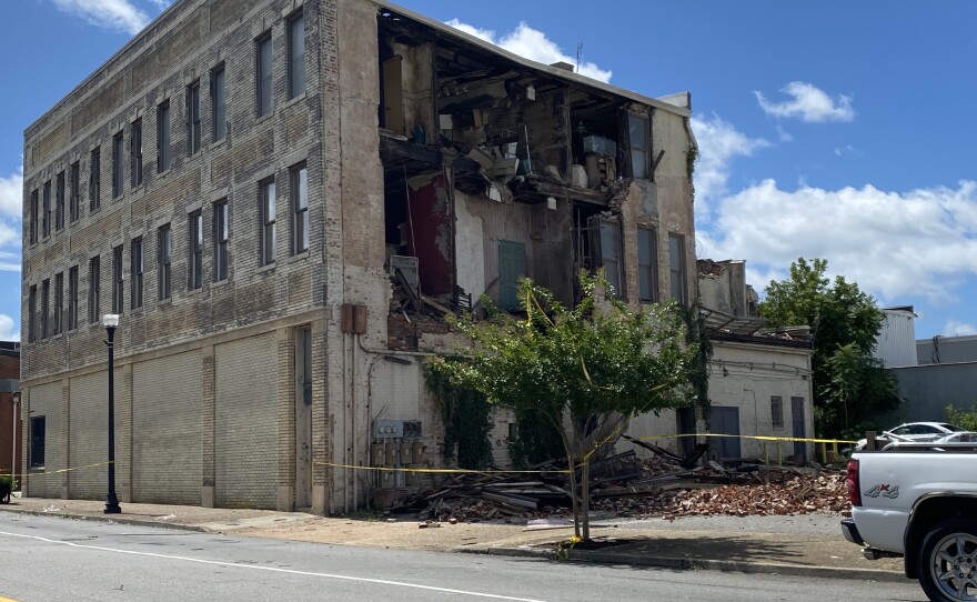
Update 8/13/24: The National Weather Service has determined that no tornadoes touched down in Suffolk on Thursday, August 8.
Suffolk saw multiple tornado warnings on Thursday.
WHRO spoke with Meteorologist Jeff Orrock from the National Weather Service’s Wakefield Office about the four different radar-indicated rotations that moved their way through the city in the afternoon.
This interview was edited for length and clarity.
Nick McNamara: With a night between us and the weather events yesterday, has the National Weather Service determined if any tornadoes touched down in Suffolk or the surrounding areas on Thursday?
Jeff Orrock: We’re going to be looking at maybe a couple little areas in Suffolk. We're not getting reports of damage. The radar has ability to try to detect debris. There's one or two places where we may see a little bit of a weak debris signature. It could have been something touched down in the woods and maybe lofted some pine needles and leaves and things like that in south Suffolk, but there's no structural damage. We're not hearing about anything as far as houses or buildings damaged.
Where we do have damages up in Caroline County, much further north. We have had a tornado go through Caroline County, and that's damaged a fair number of homes. And so we're up there doing a survey right now to kind of look at what's happened up there. But there are a couple little areas of interest.
If folks are aware of any kind of damage, or areas where they have trees down, they can definitely pass the information along to the weather service office here in Wakefield and give us a call. We think there could have been one or two, but we think it mainly happened out in the woods.
NM: How rare is it to see 4 radar-indicated rotations follow roughly the same path across a city like Suffolk?
JO: Well, in a tropical event like this it's actually pretty common. You have a band of showers with some enhanced updrafts in them and it's just like one little cell right after another in that spiral band as it comes around a tropical system. When that happens, all those little updrafts can actually start to spin and try to produce tornadoes, and they'll do it kind of in secession – almost like a train of them. So that is actually fairly common.
We had that in Isaias. Some folks remember back to Isaias when we did have tornadoes come out the dismal swamp and track through downtown Suffolk. Had about two or three of them that did the same thing. And of course, those were much worse. Those were very damaging tornadoes. In fact, we had a fatality down in North Carolina, where the storms came from. And they tracked all the way up the peninsulas, and they were just wreaking havoc with damage. It was one after the other in these bands.
When we get these spiral bands around a tropical system like this, they can definitely line up like a train, and you can get multiple tornadoes in the same band.
NM: Should we expect to see events like this more often in years to come?
JO: It's pretty typical with, I hate to say it, with tropical systems. So anytime we have a tropical system coming up this way – especially if the circulation is coming right over top of us or if it's just to our west, a lot of the tornadoes occur right on the east side of the circulation – anytime you have a tropical circulation coming up like this and you're just east of the circulation, like we were in Isaias and we were for Debby, you're going to usually see a tornado threat.
Sometimes you see one will produce more tornadoes than another, just depending on the environment. But this is pretty classic when we have tropical systems coming up here, just another one of the threats that tropical systems bring.
NM: What should we expect this afternoon and evening? Are we clear of any Debbie-related weather events in Hampton Roads?
JO: Well, there's still going to be a band, a couple bands of showers come through. Could even be a little bit of gusty wind with those showers. The tornado threat is gone, and the flooding threat is gone, but there could be a few little bands of showers that could come out of North Carolina that move from kind of the southwest going northeast.
But they'll just be kind of these rapidly passing showers. You’ll get a quick moderate-to-maybe-brief heavy rain, and then it's over. That'll be completely gone later this evening.


